
How Biophysical Monitoring Turns Data into Action for Nature-Based Solutions
Nature-based solutions expert, Stanley Chasia, explains how rigorous and consistent data analysis helps to refine strategies, attract investment, and strengthen natural infrastructure in Sub-Saharan Africa.
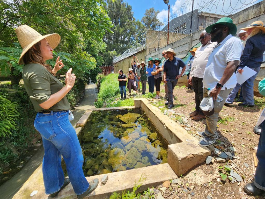
In 2024, water quality monitoring in Johannesburg’s Jukskei catchment, South Africa, revealed a remarkable seasonal pattern: concentrations of sulphate, phosphate, nitrate, ammonia, and chemical oxygen demand surged during the dry winter months of June to August—when rainfall was at its lowest—before dropping sharply in the rainy season from October to April. Collected by the City of Johannesburg’s Department of Environment, Infrastructure and Services, these findings show how rainfall-driven surface runoff dilutes pollutants in wetter months, while drier conditions concentrate them, offering crucial insight into the catchment’s ecological health.
Such findings, obtained through rigorous analysis of biophysical data, informed the design and selection of nature-based solutions (NbS) interventions—for example, the use of biofilters to reduce water pollution—within the SUNCASA project (Scaling Urban Nature-Based Solutions for Climate Adaptation in Sub-Saharan Africa) in Johannesburg. This highlights how biophysical monitoring is essential not only for tracking environmental indicators such as water quality, soil erosion, and flood risk—and making adjustments as needed—but also for scaling up successful interventions.
Operating in water catchments of three major African cities—besides Johannesburg, Dire Dawa, Ethiopia, and Kigali, Rwanda—SUNCASA project teams are planting millions of trees and removing invasive species to demonstrate how NbS interventions can deliver better returns on investment than traditional grey infrastructure for cities trying to reduce flash flood damage and tackle other growing climate change impacts. Rigorous, consistent data—like how effectively the project’s biofilters impact Johannesburg’s seasonal swings in pollutants—provides the feedback needed to refine SUNCASA’s strategies, attract investment, win over policymakers, and strengthen natural infrastructure that delivers multiple social, environmental, and economic benefits.
The Challenge: Building robust monitoring systems
Effective biophysical monitoring depends on more than occasional data collection. It requires extensive investments in reliable monitoring systems anchored on robust data collection regimes and sound institutional frameworks. Tools, models, and technical skills are also needed to transform monitoring data into actionable insights and knowledge products which can support decision-making and adaptive management.
In many catchments across Sub-Saharan Africa, regular monitoring is limited or absent, with existing datasets often incomplete or inconsistent due to gaps, duplication, or errors. Contributing factors include aging equipment, insufficient funding, limited technical capacity, and even vandalism of monitoring stations. The need for expertise in artificial intelligence, big data analytics, and data science is growing, as these fields are key to turning complex, multi-source datasets into guidance for community leaders.
SUNCASA’s biophysical monitoring approach
In SUNCASA, the impact of NbS interventions is tracked by monitoring key biophysical parameters, such as improvement in water quality and quantity, changes in soil condition and health, soil erosion control, and reduction in floods and landslides vulnerability. Both baseline and monitoring data are gathered from primary and secondary sources, such as regular government monitoring data (e.g., water quality), global data repositories from remote sensing missions, and data portals hosting various biophysical datasets for each of the three SUNCASA project cities. This information—often in different formats, scales, and resolutions—must be standardized and processed before integrating it with on-the-ground measurements.
The situation varies between project sites:
- Dire Dawa – No recent formal monitoring has taken place, limiting effective resource management.
- Kigali – The Rwanda Water Board operates automatic hydrometric stations, but other biophysical data is typically gathered only when needed.
- Johannesburg – The city conducts monthly water quality sampling in its catchment but requires additional hydrometric stations to enhance flood modelling and improve understanding of the hydrological regime.
Catchments with limited to no monitoring data can use secondary data from Earth observation missions to monitor environmental changes at NbS implementation sites. In SUNCASA, satellite imagery, such as Sentinel-2 from the European Space Agency, and Landsat from the United States Geological Survey, is being used in Dire Dawa to monitor soil moisture anomalies between precipitation, surface and sub-surface soil moisture content. Vegetation indices (e.g., Normalized Difference Vegetation Index and Enhanced Vegetation Index) are also being used to track vegetation health and changes in our NbS intervention sites.
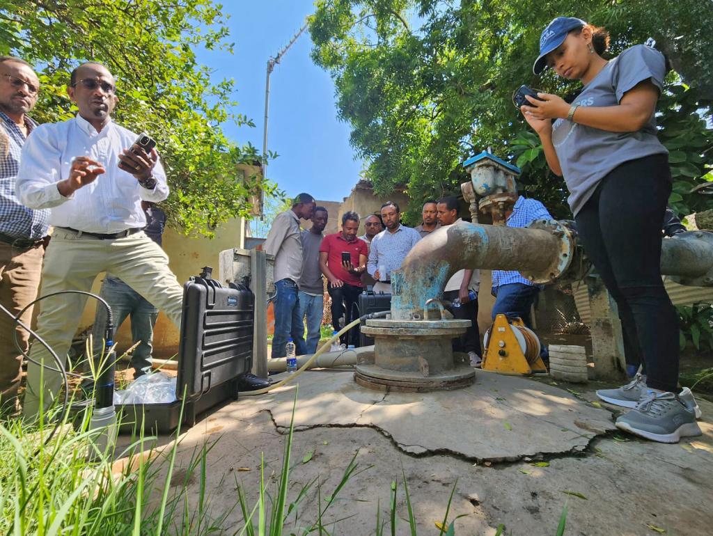
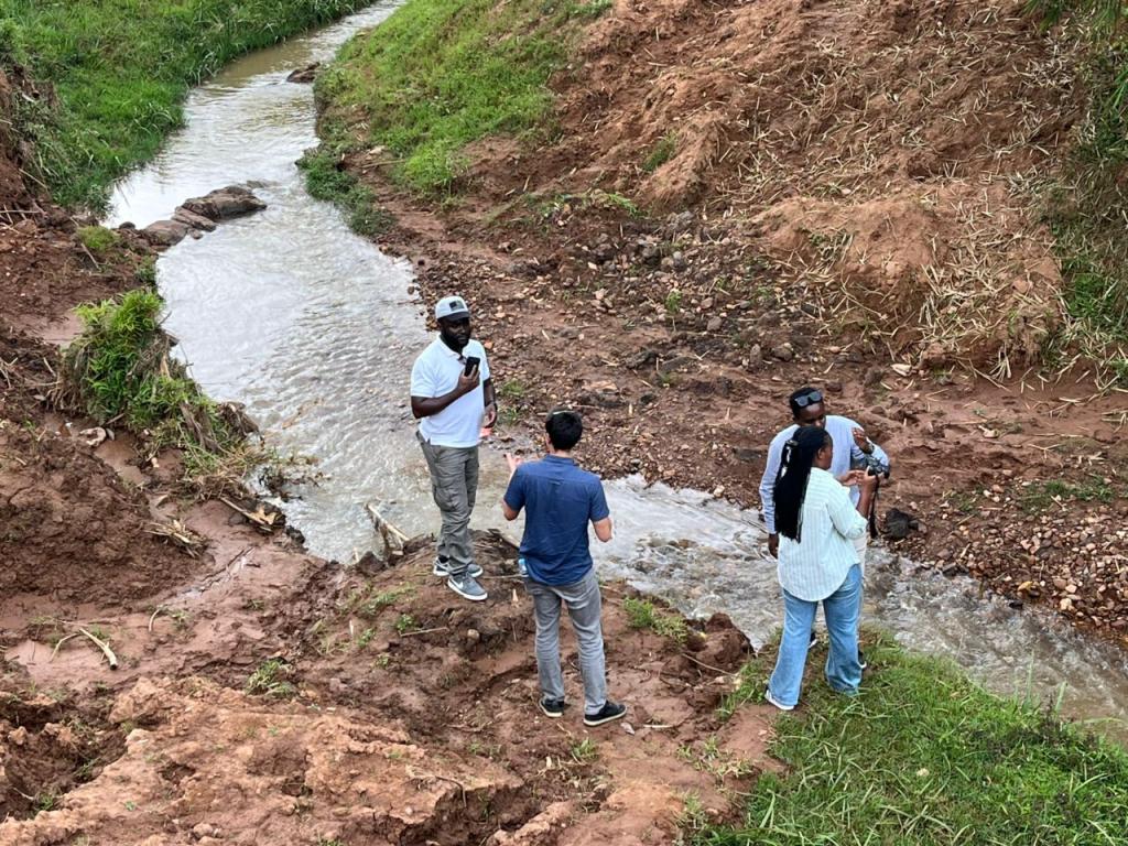
Across all three cities, NbS scenarios are being applied with hydrological and hydraulic models to understand how different interventions improve flood mitigation outcomes. In the Dechatu (Dire Dawa) and Jukskei (Johannesburg) catchments, SUNCASA is also supporting monitoring efforts by investing in additional monitoring equipment to carry out regular data collection.
For instance, in Dire Dawa, a multiparameter probe and contact gauge meter have been acquired to monitor groundwater quality and water level, respectively, to measure long-term impacts of NbS activities on groundwater recharge. In Johannesburg, the installation of additional stream gauge equipment in the Jukskei River will provide data to improve hydrological model performance and calibration, which in turn improves the accuracy of flood models and gives earlier warnings to the city.
Engaging communities in monitoring
In Sub-Saharan Africa, where an average of around 60% of people depend on agriculture, soil erosion and drought threaten food security by removing nutrient-rich topsoil. Natural ecosystems, such as trees and wetlands, help protect soil, purify air, and recharge groundwater—services that benefit communities directly.
SUNCASA is exploring participatory monitoring tools to involve community members in NbS biophysical monitoring. The growing availability of smartphones and mobile apps creates opportunities for citizen science, allowing community members to contribute to data collection, observation, and analysis—helping safeguard the ecosystems they depend on.
You might also be interested in
Treaty 3 team deploys new water monitoring devices across territory
IISD Experimental Lakes Area offered support to Grand Council Treaty 3 when it first launched its monitoring program, having done water quality work for decades.
Nature-based solutions on display at Stockholm World Water Week
From a polluted Seine River grabbing the spotlight during this year's Olympic Games to California's shrinking lakes offending the olfactory senses of its citizens, it seems like this week's World Water Week couldn't come soon enough, writes IISD's Dimple Roy.
Sustainable Asset Valuation of Waterway Rehabilitation in Cape Town, South Africa
This report analyzes the social, economic, and environmental value of restoring waterways in Cape Town.
Tackling flash floods, urban heat, and other climate change threats in three sub-Saharan African Cities
A new project will use solutions found in nature to improve the resilience of 2.2 million people in Dire Dawa (Ethiopia), Kigali (Rwanda), and Johannesburg (South Africa).